ShopDreamUp AI ArtDreamUp

Deviation Actions


Suggested Deviants


Suggested Collections


You Might Like…


Description
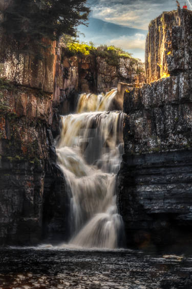
The Canadian Shield, also known as the Precambrian Shield or Laurentian Plateau, covers about half of Canada as well as most of Greenland and part of the northern United States; an area of 4.4 million square kilometers (1.7 million square miles).
It is the oldest part of the North American crustal plate and contains fossils of bacteria and algae over 2 billion years old.
The shield is composed of granite and the earth's greatest area of exposed Precambrian rock (igneous and metamorphic rock formed in the Precambrian geological era 500 million years ago).
The shield was the first part of the continent to be permanently raised above sea-level. Subsequent rising and falling, folding, erosion and continental ice sheets have created its present topography. The reoccurring invasion and withdrawal of the ice sheets (1.6 million to 10,000 years ago) depressed the surface creating Hudson Bay, scraped out tens of thousands of lake basins, carried away much of the soil cover and redeposited glacial debris.
~~~~
HDRi from a single image.
I shot this photo near dark close to my hometown of Thunder Bay, Ontario at a lovely section of the Current River known simply as the Cascades.
If you'd like, please have a gander at my mini-gallery devoted to Moving Water
.
Image size
502x673px 544.41 KB
Comments17
Join the community to add your comment. Already a deviant? Log In
Now here's a palette of colors you don't see everyday in a forest landscape. I love the earth tones of this one!